Drone roof inspection photography in San Antonio
Overhead and oblique roof and exterior photos from an FAA Part 107 drone pilot, delivered as an organized, labeled set.
Why we fly instead of climb
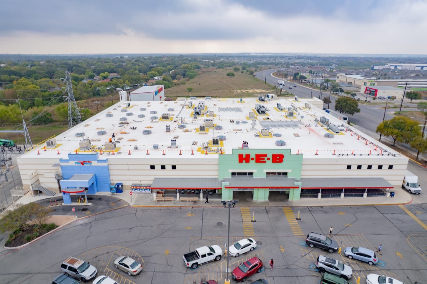
A drone captures roof surfaces, edges, and penetrations from the air, so nobody has to walk the roof to get the photos.
The drone does the roof. You stay on the ground.
What you receive
Roof condition photos and video only. Nothing is interpreted or scored.
- Overhead stills
- Top-down photos of every roof surface.
- Oblique stills
- Angled photos of flashing, penetrations, edges, and drainage.
- Exterior elevations
- Photos of each side of the building.
- Video walkaround
- A short 4K flight around the roof and exterior.
- Labeled photo set
- Files organized and named by location on the property.
- Download link
- Everything delivered by digital download link.
How a roof flight works
Request
Send the property address and what you need photographed through the quote form.
Schedule
We check airspace and weather for the site, then confirm a flight time.
Flight
We fly the roof and exterior with a DJI Air 2S. Nobody goes on the roof.
Delivery
You receive the labeled photo set and video walkaround by download link.
Visual condition assessment pricing
Commercial roofs start at $395 and scale with roof area.
| Roof type | One-time | Recurring contract | Portfolio, 5+ properties | Book |
|---|---|---|---|---|
| Residential roof | $225 | $200 | $185 | |
| Commercial roof | from $395 | By quote | By quote |
This is a visual condition assessment only. It uses standard photo and video, with no thermal or infrared imaging, and it does not detect moisture.
Roof inspection drone service FAQ
Will you tell me what is wrong with the roof?
No. We capture and deliver imagery only. We do not give opinions on what caused damage, whether insurance covers it, or whether repairs are needed. Your roofing contractor, public adjuster, carrier, or other professional reviews the photos.
What drone and camera do you fly?
A DJI Air 2S with a 1-inch, 20MP sensor. It records 4K video for the walkaround.
Are you licensed to fly commercially?
Yes. Every flight is flown by an FAA Part 107 certified remote pilot.
Do you offer thermal imaging, mapping, or 3D models?
No. This service does not include thermal imaging, zoom-lens inspection, moisture surveys, orthomosaics, mapping, 3D models, or volumetric measurements.
How do I receive the photos?
You get an organized photo set with labeled locations and a short video walkaround, delivered by digital download link.
What area do you cover?
San Antonio, Bexar County, and the greater San Antonio area, including New Braunfels, Boerne, Schertz, Cibolo, and Seguin.
Pairs well with
Get roof photos without anyone on the roof
Send the property address and what you need documented, and we will reply with a quote.